In our fast-paced reality, characterized by the demand for rapid access to information and seamless collaboration, IT solutions must offer simplicity, efficiency, and robust data security.
With this in mind, we are thrilled to introduce GIS GeoGrid 1.5, the latest iteration of our innovative solution packed with features designed to meet these evolving needs. Let’s delve into the enhancements!
What’s new in GIS GeoGrid 1.5?
Streamlined Information Sharing for Reports and Scripts
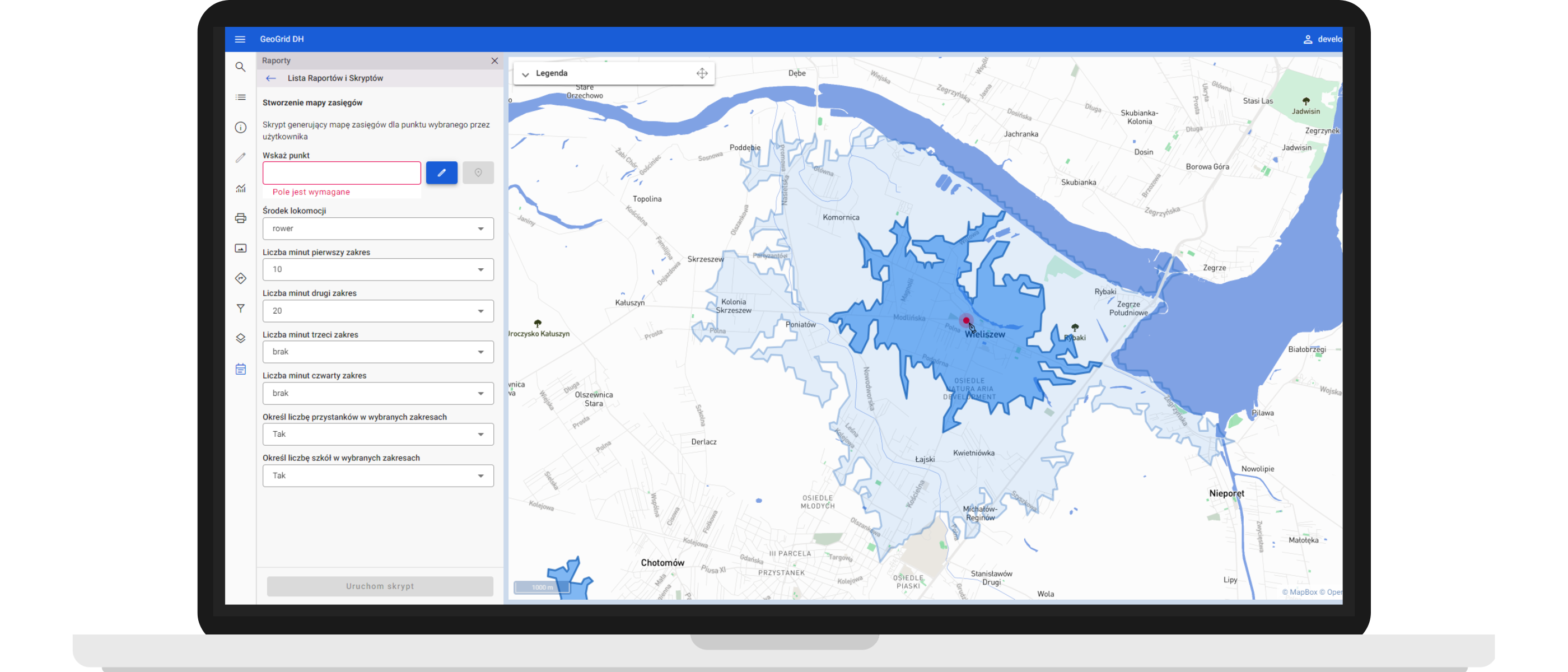
If you incorporate data from diverse sources, including internal databases and external public repositories, you can visualize them within a unified system, GeoGrid. It’s integrated with an ETL system, the FME Platform.
Expanding on our integration with the FME Platform server, GeoGrid 1.5 introduces new parameters, including the ability to select disc files and layers and specify points and areas on a map.
These additions empower users to effortlessly share input data with FME, facilitating efficient data processing. For example, when scouting optimal locations for new retail or service ventures, users can now seamlessly share specific map points, facilitating the generation of coverage areas. This enables precise analysis of potential locations, ensuring informed decision-making for investments.
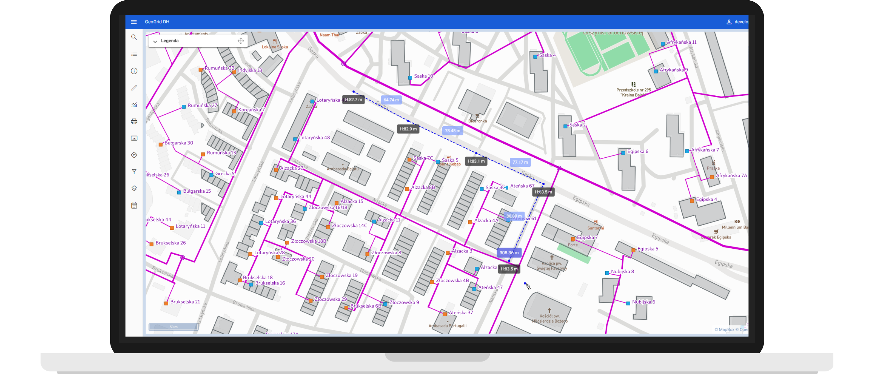
Enhanced Measurement Capabilities
With GeoGrid 1.5, measuring distances and coverage areas is just the beginning. Users can now determine altitude at any point on the map, a particularly valuable feature for tasks involving terrain-based information, such as designing heating networks.
These new capabilities expedite tasks while enhancing precision in measurement. They enable more refined estimations of construction material quantities, effectively mitigating costs associated with over- or underestimations.
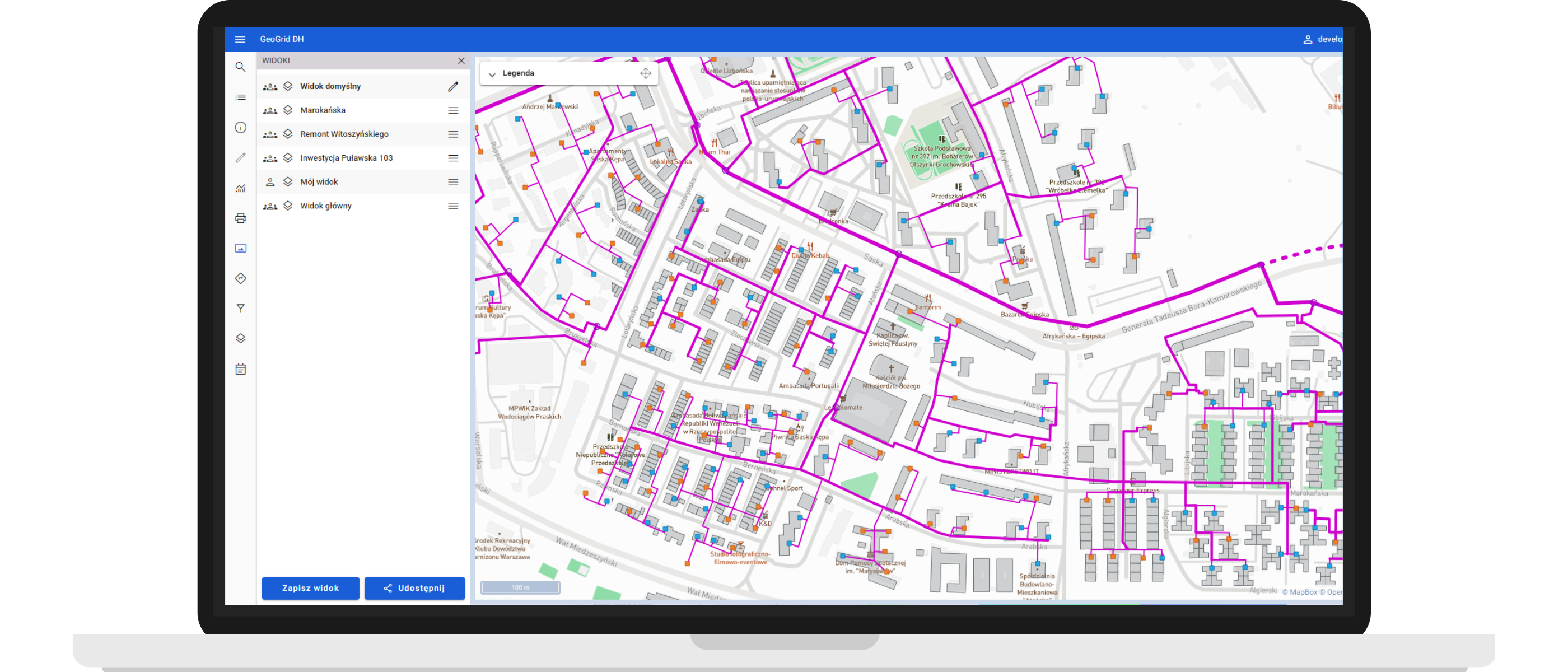
Simplified Information Sharing
Often, multiple teams require simultaneous access to a singular dataset, necessitating seamless information sharing. GeoGrid 1.5 introduces a feature to share objects and map views via a simple link, eliminating the need for cumbersome IDs or object names. This streamlined sharing process accelerates collaboration and facilitates integration with other systems, granting users effortless access to specific objects within GeoGrid. Particularly advantageous for field teams, the shared map views precisely delineate areas requiring attention, expediting their workflow.
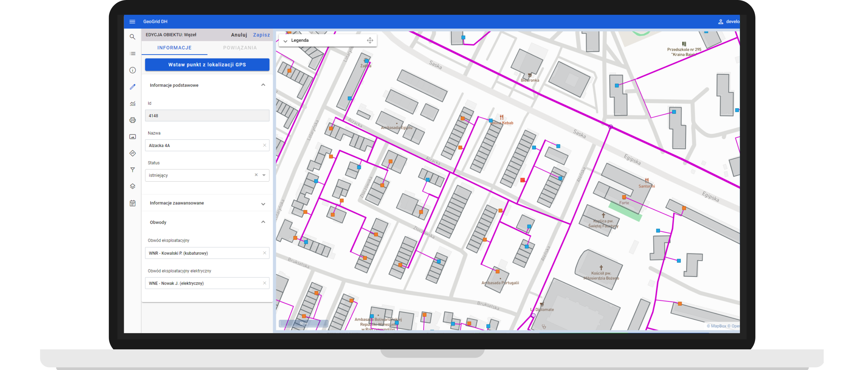
Enhanced Attribute Management
Building upon the attribute management function introduced in the previous release, GeoGrid 1.5 now extends attribute grouping to object editing. This organizational enhancement not only simplifies attribute browsing but also accelerates workflow efficiency.
The image below illustrates the organization of object information into three categories: basic information (such as ID, name, and status), advanced information, and circuits (including operational and electrical).
If you found this article insightful and are interested in exploring how GeoGrid can benefit your business, don’t hesitate to contact us to schedule a free demo and experience the power of GeoGrid 1.5 firsthand.
Explore other articles:
GIS GeoGrid for commercial real estate rental: streamlining operations and improving customer engagement
Effective use of geospatial data - application of location analytics in the insurance industry
Globema expands OSS portfolio through the acquisition of NetVersant Designer from Versant Solutions Group