
According to Gartner, about 80% of business data include spatial context. Incorporating the location aspect by presenting data on a map can help you improve your business processes and user experience. It’s worth it to leverage the capabilities of modern geospatial applications.
Custom solution based on existing components – why is it worth it?
Have you considered using geospatial solutions but publicly map tools didn’t meet your expectations? They were too basic for your business processes or had too many unnecessary features. At the same time, building specialized applications can be too expensive and time-consuming, additionally, it requires unique skills.
The solution that you’re looking for is software created with existing components, customized to your specific business needs. We offer this capability through our GeoPlatform solution.

GeoPlatform is a platform for building personalized solutions based on existing components. Its main feature is creating advanced map applications that smoothly operate on large data volumes. With GeoPlatform, you can also add maps to your existing websites as well as web and mobile apps.
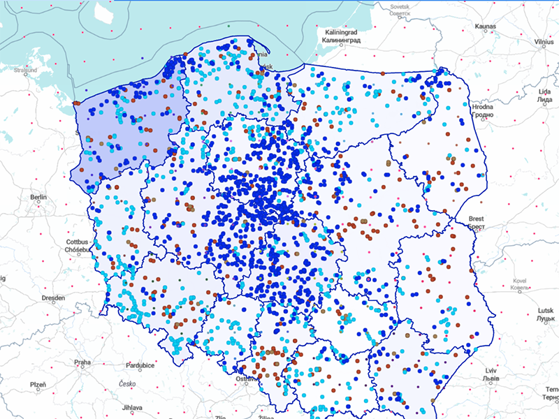

Maps created with GeoPlatform are dynamic, efficient, and can be easily configured. They allow you to visualize any data from different sources: company internal systems, .csv files, external services, etc. They are also equipped with personalized editing tools and can be expanded with modules, such as geocoding, fast search, autocomplete, or routing (route tracking).
Solutions tailored to your needs and based on GeoPlatform allow you to monitor, manage, analyze, and share data visualized on maps, exactly the way you like. This results in more effective task completion, increased productivity, and improved goal achievement.
What are the benefits of using GeoPlatform?

Lower cost
Implementing a solution built with GeoPlatform is related to significantly lower costs in comparison with a fully stand-alone solution. This is because we use existing, tested components.

Fast implementation
Using existing front- and back-end components considerably speeds up the process of creating the solution. We can build a custom map application in as little as 2 months*.

High quality and reliability
We create our components using the best practices and newest technologies. We constantly develop them to guarantee their reliability.
*time depends on solution complexity.
Get to know our solutions based on GeoPlatform
For years we’ve been creating custom map applications for industries and companies such as:
Telecommunications and other network organizations
Retail & e-commerce
Real estate
Government institutions
Finance & insurance
IoT & wearables
Postal & courier services
All kinds of companies hiring field service employees (technicians, sales representatives, etc.)
See our solutions based on GeoPlatform:
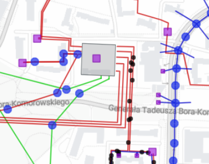
- GeoGrid – a web app for companies with any kind of field infrastructure. It features presenting and editing GIS data directly on maps.
- PrognOZEr – a service showing aggregated forecasts of energy production from renewable sources such as sun and wind
- ELGrid – a system for supporting the development and optimization of energy network operations together with dispersed energy sources, energy warehouses, and controllable receptors.
- 4RES – a system providing forecasts for renewable energy production in the short- and medium-term, using aggregated predictive models.
- LocDoc – an application that automates the categorization of scanned documents and gives every employee easy access to their content.
- Soral – a web application for monitoring the technical condition and assessing the risk of failures of MV cable lines