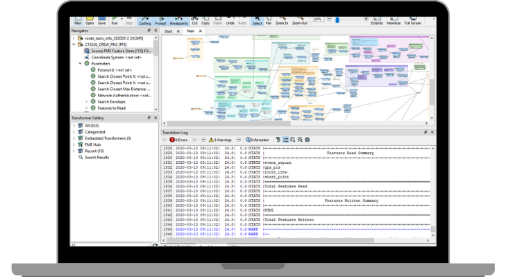
Create data processing scripts effortlessly using a drag-and-drop interface. With FME, programming skills are not required to transform your data.
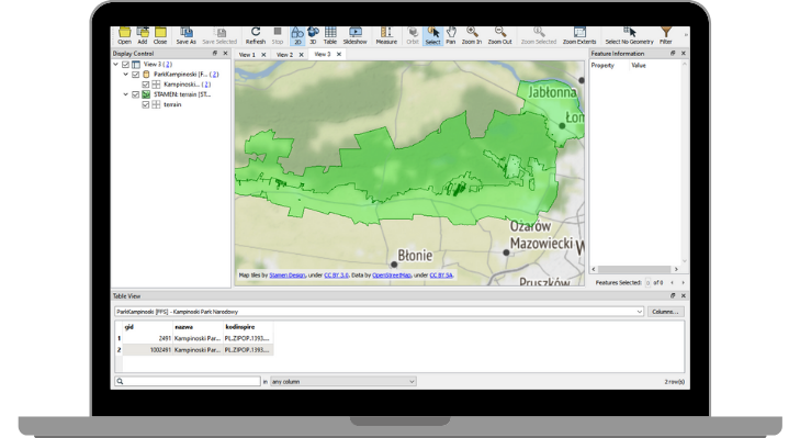
FME Data Inspector
A data browser that allows you to explore data before, during, and after creating your script. FME Data Inspector visualizes data and previews their attributes. Thanks to simultaneous data processing and validation, you can ensure your script works flawlessly.
How can FME help you?
- Integrate data from different sources and systems
FME Form (formerly Desktop) supports reading and saving data in over 450 formats and sources. You have the flexibility to choose the tools and apps you need for your work. - Seamlessly process your data
Utilize FME’s rich transformer library to process your data according to your specific needs. Connect specific transformers to create a perfect dataset. You can parameterize your scripts for enhanced flexibility. - Convert data to any format or coordinate system
Need to work with unfamiliar formats or coordinate systems? FME swiftly converts data between different formats and popular coordinate systems, including local coordinate systems. - Validate and control your data
FME offers validating transformers to easily verify data correctness at any transformation stage. Stay informed about potential data errors and how to rectify them using FME. 😊

Transformers
FME includes a comprehensive library of tools to transform and convert data. Some popular features include:
Tester
Evaluate one or more tests on a feature and route the feature according to the test outcome(s).
AttributeCreator
Add one or more attributes to the feature and optionally assign values derived from constants, attribute values, and expressions.
AttributeManager
Alter multiple attributes by adding, renaming, copying, and deleting. Set values for new, existing, and modified attributes using constants, attribute values, conditionals, and parameters.
FeatureMerger
Merge attributes and/or geometry from one set of features onto another based on matching key attribute values and expressions.
Inspector
Send features to the FME Data Inspector for display.
AttributeKeeper
Remove all attributes and list attributes, except the specified ones you want to retain.
TestFilter
Filter features by test conditions to one or more output ports.
Creator
Create features using supplied parameters and send them into the workspace for processing.
Reprojector
Reproject feature coordinates from one coordinate system to another.
Clipper
Perform geometric clipping operations, sometimes called a “cookie cutter.” Most geometry types can be clipped by an area, and some may also be clipped by a solid. Attributes may be shared between objects through spatial joins.