
At the Smart Geospatial Solutions Conference 2017 Ed Boiling, Solution Architect at Google, gave a presentation “Making Better Business Decisions with Google Maps and Cloud”. Ed described how Google Maps and location data can support commercial decisions and ensure more efficient delivery of products and services.
There are many businesses and institutions asking real-world questions about location. Understanding how the world moves could help them improve decision making process. Here is a good example – big cities that were spending hundreds of dollars on putting sensors in their roads to obtain useful information on traffic and commuting patterns. Such data is inevitable to answer questions like: where to build next highway or where municipal services staff should be on standby on a specific day and time.
On a daily basis we use location data to find the nearest coffee shop or nearby hotels. What’s more, we now expect businesses to do the same and to also make use of location data and services. Example? Taxi companies which use Google Maps and live traffic data to make accurate journey predictions. Such data, along with the current location of a taxi cab, is used to distribute rides. Passengers also knows, for example, when they should leave their flat or hotel room so that they don’t have to wait outside for a taxi.
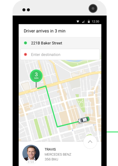
Applications based on Google Maps enable passengers to make accurate journey predictions.
Delivery companies use Google Maps to optimize routes and to estimate delivery time. For such businesses any delay may result in losing customers and money. Google Maps helps business owners to get real-time information about the most optimal delivery routes and provide means to share this data with their drivers. This is how delivery companies can reduce transportation costs. What’s more dispatchers can track vehicles in real-time and thanks to that act immediately in case of an emergency.
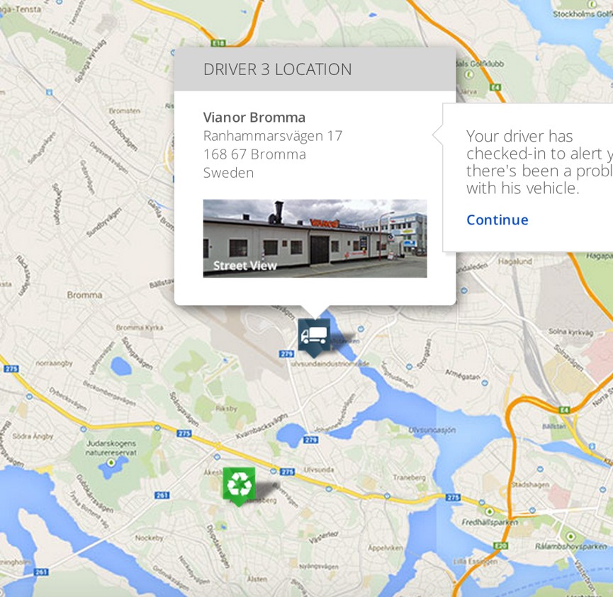
A dispatcher can track the vehicle in real-time which enables him to take a prompt action in critical situation.
Location based services and Google Maps enter new areas. In Starbucks you will be able to order your favourite drink only with few clicks on your mobile device. Popular coffee chain uses Google’s real time traffic feed from the Directions API to get data about the time of your arrival to the coffee shop. Thanks to that Starbucks is ensuring your coffee is hot by preparing it just in time.